-40%
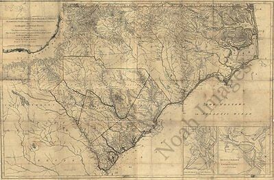
Map of North and South Carolina c1775 repro 36x24
$ 5.25
- Description
- Size Guide
Description
Map of North and South Carolina c1775 repro 36x24Item Description
An accurate map of North and South Carolina, with their Indian frontier, shewing in a distinct manner all the mountains, rivers, swamps, marshes, bays, creeks, harbours, sandbanks and soundings on the coasts; with the roads and Indian paths; as well as the boundary or provincial lines, the several townships, and other divisions of the land in both the provinces; the whole from actual surveys by Henry Mouzon and others. Shows precinct boundaries. Insets: The harbour of Port Royal --The bar and harbour of Charlestown.
Reproduction print.
Size :
36"
x
24"
½" inner white borders all around.
Please check out our Ebay store regularly for eclectic choices of fine reproduction maps and posters prints!
Thank you for looking, and Happy Bidding!


